
The Indivisible Province: Why Sindh’s Geography Cannot Be Redrawn
For context, the Indivisible Province: Why Sindh's Geography Cannot Be Redrawn.
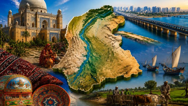
For context, the Indivisible Province: Why Sindh's Geography Cannot Be Redrawn.
Article outline
- What happened
- The key numbers
- Reaction
- Official response
- What comes next
- The bottom line
Key points
- Not A Single Drop More: Why The Indus Waters Treaty Cannot Be Unilaterally Held In Abeyance.
- The Illusion Of A Quiet Monsoon: Why Flood-Preparedness In Pakistan Cannot Wait For The Storm.
- When the British separated Sindh from the Bombay Presidency in 1936, they restored an ancient province rather than manufacturing a new one.
- Geography Is Not Enough: Pakistan And The New Rules Of Trade.
- The real, sustainable remedy lies in constitutional compliance with Article 140A through genuine political, administrative, and fiscal devolution to local governments.
Carving out a new province does nothing to resolve municipal dysfunction. Karachi's metropolitan fabric is already fractured among more than seventeen separate administrative agencies.
For context, a recurring pattern in Pakistani politics is the periodic recycling of failed propositions disguised under fresh bureaucratic terminology. The demand to partition Sindh has resurfaced once again, carefully wrapped in the technocratic vocabulary of administrative efficiency, demographic parity, and governance reform. Yet beneath this rebranding lies a fundamental conceptual flaw: confusing an institutional failure of governance with a difficulty of territorial configuration. Governance deficits and service-delivery failures are structural. They are resolved through institutional strengthening and fiscal decentralisation, never by arbitrarily redrawing provincial boundaries on a map.
Pakistan's constitutional framework leaves no ambiguity regarding the sanctity of provincial borders. While Article 239 governs the general mechanism for constitutional amendments requiring a two-thirds majority in both houses of Parliament, Article 239(4) introduces an indispensable safeguard specifically for provincial boundary alterations. Under this clause, no bill altering provincial limits can even be presented to the President for assent unless it has secured the approval of at least two-thirds of the total membership of the affected provincial assembly.
This constitutional prerequisite establishes two strict parameters. First, the threshold demands two-thirds of the total membership, meaning that absent or abstaining legislators count against the threshold. Second, the provincial assembly possesses an absolute legal veto that cannot be circumvented through executive decrees, parliamentary majorities, or consultative instruments like Article 48(6). The Sindh Assembly has exercised this constitutional authority unequivocally, passing binding resolutions rejecting division in 2014, 2019, and February 2026. This united political consensus spanning the PPP, GDA, all nationalist parties, and civil society as a whole makes Sindh's territorial integrity a closed constitutional matter.
Those who propose partitioning Sindh treat the province as if it were an artificial administrative contrivance created by bureaucratic decree that can be redrawn at political convenience. This premise is historically untenable. Sindh is one of the world's oldest continuously named civilisational and political territories. Derived from the ancient Sindhu river; the etymological root of Hindu, Indos, and India, its distinct identity endured throughout the Soomra, Samma, Kalhora, and Talpur dynasties, through the Mughal era, and under British rule after the annexation of 1843.
Pakistan did not grant Sindh its boundaries, but inherited Sindh as an intact, organic entity with an enduring pluralistic heritage and centuries-old intellectual traditions.
When the British separated Sindh from the Bombay Presidency in 1936, they restored an ancient province rather than manufacturing a new one. Crucially, on March 3, 1943, the Sindh Legislative Assembly became the first elected legislature in British India to formally adopt the Pakistan Resolution. Pakistan was founded as a voluntary federation of pre-existing historical units; Pakistan did not grant Sindh its boundaries, but inherited Sindh as an intact, organic entity with an enduring pluralistic heritage and centuries-old intellectual traditions.
Beyond constitutional and historical realities, the physical geography of the Indus Basin presents an insurmountable barrier to division. Sindh's entire agrarian economy, ecology, and urban survival depend on an indivisible irrigation cascade comprising three interconnected barrages: Guddu (1962), Sukkur (1932), and Kotri (1955). Water releases at Guddu determine downstream levels at Sukkur, Sukkur feeds Kotri, and Kotri sustains the vulnerable Indus Delta and coastal mangrove ecosystem.
Notably, the network of nineteen thousand kilometres of irrigation canals feeding 5.8 million hectares was engineered to operate under a single, unified provincial jurisdiction. Slicing the province geographically would bifurcate barrages from their command areas, instantly transforming routine water distribution into contentious inter-provincial disputes. Karachi's municipal survival exemplifies this absolute dependency: the metropolis relies on approximately 570 to 600 million gallons of water daily conveyed via the Kalri Baghar Feeder from Keenjhar Lake in Thatta district. The 1991 Water Apportionment Accord recognizes Sindh as a single, indivisible signatory; fracturing the province would collapse the legal and hydrological stability of the entire river basin.
Proponents of division frequently justify their claims by alleging that Karachi faces deliberate provincial neglect. Nevertheless, comprehensive empirical evidence from the District Vulnerability Index for Pakistan (DVIP- November 2025) challenges this narrative. The index establishes that the four least vulnerable and most socioeconomically developed districts in all of Pakistan are located within Karachi; namely Karachi Central, Karachi Korangi, Karachi South, and Karachi East, ranking higher than other major urban centers like Lahore, Islamabad, and Rawalpindi. Throughout six multi-sectoral domains, these Karachi districts exhibit superior infrastructure: near-zero average distances to basic health units and maternal care facilities, the nation's highest public school densities per square kilometer, low unemployment and unpaid family helper ratios, and minimal incidences of kacha or single-room housing.
These data demonstrate that, despite legitimate criticisms of subdued provincial governance, public investments and service delivery have favored the metropolitan center far more than the underserved rural hinterlands.
Conversely, the DVIP exposes stark intra-provincial disparities that place the burden of underdevelopment squarely on Sindh's rural and other districts. While Karachi's metropolitan core occupies the top four spots nationally, interior districts face severe structural deprivation: Tharparkar ranks 120th nationally with the country's highest demographic vulnerability, Sujawal ranks 105th, Thatta ranks 102nd, and districts like Badin, Jacobabad, and Kashmore suffer acute deficits in basic services, sanitation, and potable water. These data demonstrate that, despite legitimate criticisms of subdued provincial governance, public investments and service delivery have favored the metropolitan center far more than the underserved rural hinterlands.
Acknowledging legitimate administrative grievances in urban Sindh remains essential. Karachi's municipal authorities require greater empowerment, the 1973 urban-rural employment quota necessitates legislative review and merit-based modernization, and fiscal reinvestment into municipal infrastructure must reflect the city's economic contributions. Nevertheless, carving out a new province does nothing to resolve municipal dysfunction. Karachi's metropolitan fabric is already fractured among more than seventeen separate federal, provincial, and military land-owning entities; including cantonment boards, the Defence Housing Authority, Karachi Port Trust, Pakistan Railways, and the Civil Aviation Authority. Creating an extra provincial tier merely introduces another layer of bureaucracy over an already fragmented territorial landscape.
For context, the Illusion Of A Quiet Monsoon: Why Flood-Preparedness In Pakistan Cannot Wait For The Storm.
Meanwhile, the real, sustainable remedy lies in constitutional compliance with Article 140A through genuine political, administrative, and fiscal devolution to local governments. A functional and predictable Provincial Finance Commission (PFC) award, alongside empowered municipal councils and targeted civil service reforms, will resolve governance bottlenecks without triggering catastrophic political instability.
Since the founding of Pakistan, Sindh has stood as an extraordinarily accommodating partner in the federation. It welcomed millions of displaced persons during Partition, housed the nation's first capital, conceded priority over its natural gas, and consistently integrated displaced populations from nationwide. That historical generosity is a matter of record. Yet that partnership is bounded by one unshakeable principle: the federating unit that entered Pakistan whole will never consent to its own partition. Institutional collapse demands administrative solutions, not territorial amputation. Sindh will continue to contribute generously to Pakistan, but Sindh will remain indivisible.
In short, the Indivisible Province: Why Sindh's Geography Cannot Be Redrawn is the central thread here, and readers can expect follow-up reporting as the picture becomes clearer.