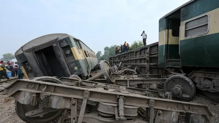
Uttarakhand’s Himalayan vulnerability
Uttarakhand has experienced thousands of recorded disaster incidents over the past decade, including floods, landslides, cloudbursts and avalanches.
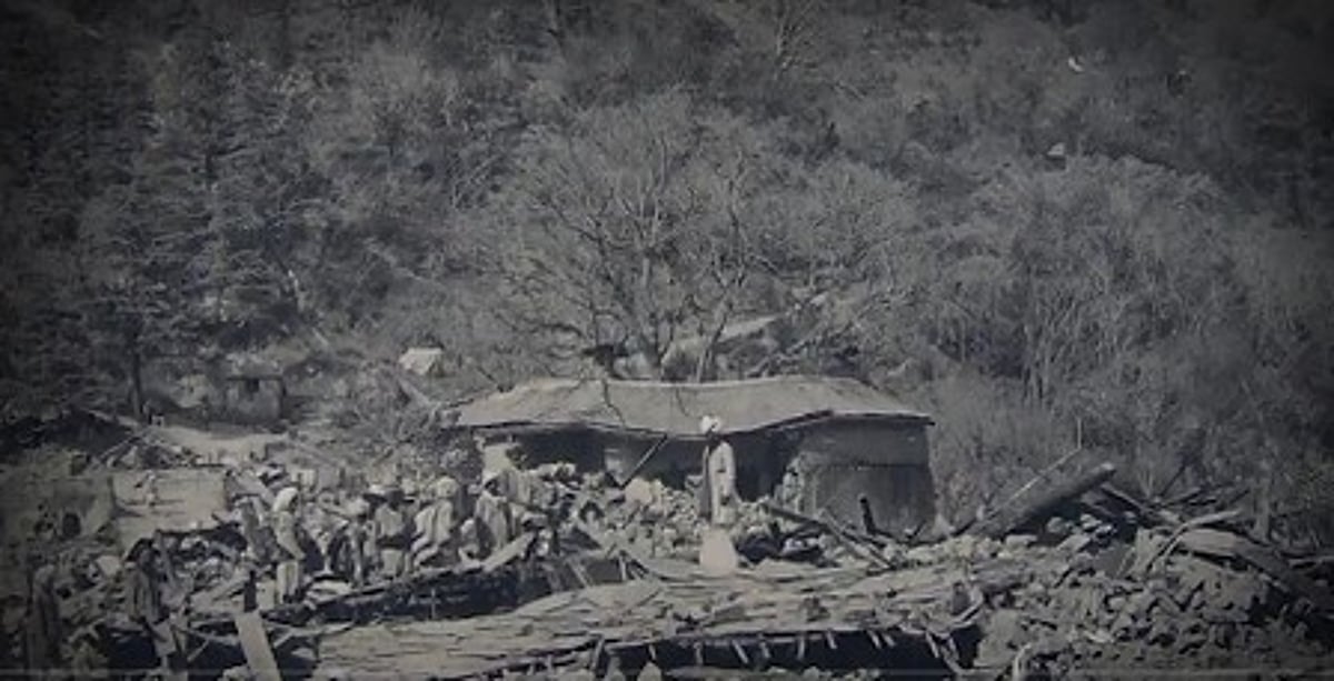
Uttarakhand has experienced thousands of recorded disaster incidents over the past decade, including floods, landslides, cloudbursts and avalanches.
Article outline
- What happened
- Why it matters
- The key numbers
- Background
- Official response
- The bottom line
Key points
- December 18, 2012: The Bhagirathi Eco-Sensitive Zone, extending from Gaumukh to Uttarkashi and covering approximately 4, 179.59 sq km, was notified by the Union environment ministry.
- State Disaster Management Department data for 2015-2024 recorded an average of approximately 2, 051 disaster incidents annually.
- August 2012: Flash floods and landslides in the Asi Ganga and Bhagirathi catchments caused deaths and extensive damage in Uttarkashi district.
- The destructive event at Dharali in Uttarkashi district on August 5, 2025 brought these tensions into sharp focus.
- June 2013: The Kedarnath-Mandakini disaster caused thousands of deaths and became one of Uttarakhand's worst disasters.
Meanwhile, the risk is rooted in the geography of the Himalayan state. Uttarakhand's steep slopes, narrow valleys, fractured rock formations and sediment-rich rivers can turn intense rainfall into flash floods, debris flows and landslides. The danger is compounded where roads, buildings, bridges and other infrastructure occupy riverbanks, floodplains or unstable slopes.
Meanwhile, the number of individuals and assets exposed to these hazards has grown. While roads, hydropower projects, tunnels, hotels and settlements have expanded into increasingly tough terrain, tourism and pilgrimage are major economic drivers. The matter, therefore, is not whether Uttarakhand should develop, but where and how development can take place without magnifying the consequences of natural hazards.
For context, the destructive event at Dharali in Uttarkashi district on August 5, 2025 brought these tensions into sharp focus. A year afterwards, the questions remain fundamental: how vulnerable is Uttarakhand's Himalayan landscape, what is driving the growing exposure, and can infrastructure and tourism be planned around the limits imposed by the terrain rather than against them?
2000: Uttarakhand was formed as a separate state, with much of its territory in the Himalayan region. 2010: A number of parts of the state experienced severe monsoon-related disasters.
August 2012: Flash floods and landslides in the Asi Ganga and Bhagirathi catchments caused deaths and extensive damage in Uttarkashi district. Official assessments documented disruption to roads, bridges and access to dozens of villages.
December 18, 2012: The Bhagirathi Eco-Sensitive Zone, extending from Gaumukh to Uttarkashi and covering approximately 4, 179.59 sq km, was notified by the Union environment ministry. The notification prohibited or regulated certain activities rather than imposing a blanket ban on all infrastructure.
February 2021: A flood in the Rishiganga-Dhauliganga valley caused extensive loss of life and damage to infrastructure.
October 2021: Exceptionally heavy rainfall affected Kumaon and other parts of the state.
August 5, 2025: Dharali in Uttarkashi district was struck by a destructive surge carrying mud, boulders and debris. Initial reports attributed the event to a cloudburst, but the India Meteorological Department did not immediately verify the precise meteorological cause.
2026: One year after Dharali, questions remain regarding how Uttarakhand can reconcile development, tourism and pilgrimage with the risks of its fragile Himalayan terrain.
Scientists concerned as Himalayas show signs of climate breakdown Why is Uttarakhand so vulnerable to disasters?
Uttarakhand lies in the geologically young and tectonically active Himalaya. The range was formed by the continuing collision of the Indian and Eurasian plates-not the "Sino-Siberian and Gondwana plates". The region contains major thrust faults and highly deformed rock formations.
Its slopes are steep, its valleys are narrow and its rivers carry sizeable quantities of sediment. While loose glacial, landslide and river deposits can be easily mobilised during intense rainfall, rocks are folded, fractured and faulted.
When rainwater enters cracks and fills the spaces between soil and rock particles, pore-water pressure rises and friction falls. The slope's resistance decreases, allowing rocks, soil and debris to move downhill, sometimes with little warning.
Human activity can growth the danger. Road cutting, hydropower projects, tunnels, railways, poorly planned settlements, construction on floodplains and the dumping of excavated material can disturb slopes and obstruct natural drainage. What happened at Dharali on August 5, 2025?
Dharali, in Uttarkashi district's upper Bhagirathi valley, was hit by a destructive rain-related surge carrying mud, boulders and other debris. Buildings and other structures were buried or swept away.
Initial reports recorded a number of deaths and dozens of missing residents. While noting that earlier official death figures had been revised, a week after the event, the BBC documented that one body had been recovered and 66 residents remained unaccounted for. Since casualty figures changed during the rescue operation, reports should distinguish clearly between confirmed deaths, missing residents and persons feared buried.
For context, the event additionally demonstrated that a debris flow is not simply a conventional flood. Fast-moving mud, rocks and boulders can exert enormous force, destroy buildings and roads, and abruptly alter the course of a stream. Is every episode of extreme rain a cloudburst?
No. The IMD's commonly cited operational definition of a cloudburst is rainfall of at least 100 mm within one hour over a small area of roughly 20-30 sq km.
In mountainous terrain, rain gauges may not be located directly beneath the most intense part of a storm. Therefore, a locally described "cloudburst" may not always satisfy the instrument-based definition. In the case of Dharali, the term was widely applied in early reports, but the event's exact cause required scientific investigation. What else can cause a destructive surge? Notably, a destructive surge can result from. Intense rainfall over an upstream catchment. The failure of a temporary landslide dam. The overflow or sudden drainage of a glacial lake. In practice, the release of water blocked by debris, boulders or fallen trees.
For context, a debris flow generated by rainfall-induced slope failure.
Meanwhile, the hazard is particularly severe when a steep catchment funnels water and debris into a narrow valley. Why do intense rains produce such devastating floods?
Steep catchments allow rainwater to reach streams rapidly instead of spreading throughout a broad floodplain. The water can pick up soil, trees, rocks and construction debris, turning into a dense and destructive debris torrent.
Buildings, roads and embankments may narrow natural drainage channels. Bridges and culverts can become blocked by boulders and uprooted trees, temporarily storing water upstream. When the obstruction fails, the published flow can hit downstream settlements with little warning. Which districts are most exposed to landslide risk?
In practice, the Landslide Atlas of India, prepared using satellite-based and socio-economic data, ranked Rudraprayag first and Tehri Garhwal second among 147 assessed districts for landslide risk exposure.
Chamoli and Uttarkashi additionally face highly high exposure since of glaciated catchments, pilgrimage routes and unstable slopes. Pithoragarh, Bageshwar, Pauri Garhwal, Nainital and the hilly areas of Dehradun face significant landslide and flash-flood risks. Why are the Char Dham corridors vulnerable?
Meanwhile, the routes to Yamunotri, Gangotri, Kedarnath and Badrinath pass through narrow valleys, steep slopes, active landslide zones, streams and erosion-prone riverbanks.
While excavation can expose fractured rock, road cutting can remove backing from a slope's base. Poorly managed muck can enter rivers, cover farmland or block natural drains. Heavy traffic and seasonal crowds growth the number of residents exposed when roads or settlements are cut off. Why is the Yamunotri corridor particularly vulnerable?
Meanwhile, the Yamunotri corridor in Uttarkashi district includes steep slopes and constricted sections along the Yamuna River system. These conditions can amplify the effects of intense rainfall, landslides and debris flows.
Meanwhile, the Kedarnath route lies in the Mandakini catchment, whose destructive potential was demonstrated during the 2013 disaster. Heavy traffic, roadside construction, slope cutting and sizeable seasonal crowds rise exposure, even when the underlying natural hazard remains unchanged.
For context, a slope becomes saturated when prolonged or repeated rainfall fills the spaces between soil and rock particles with water. The continued water increases the slope's weight and can reduce its internal strength.
Meanwhile, a final short spell of heavy rain may then trigger failure even if that spell does not meet the definition of a cloudburst. This is why landslides can occur after the most intense rainfall has already concluded. What are the warning signs of slope failure? New cracks in the ground, roads or buildings. Trees, poles or walls beginning to tilt. Bulging or newly damaged retaining walls. Unusual muddy seepage or changes in spring flow. Doors and windows becoming tough to open. New sounds such as cracking, grinding or rumbling.
Early-warning systems should consider cumulative rainfall, antecedent soil moisture and observed slope movement-not only the rainfall recorded in a single hour. How frequent are disasters in Uttarakhand?
State Disaster Management Department data for 2015-2024 recorded an average of approximately 2, 051 disaster incidents annually. While more than 4, 000 landslides were recorded throughout the districts, heavy rainfall and floods accounted for 12, 758 incidents. The same period included 67 documented cloudburst events and 92 avalanches.
These figures represent recorded incidents, not necessarily separate large-scale disasters. They may include events that caused different levels of death, damage or disruption. Uttarkashi reportedly recorded 1, 525 incidents over nine years in one departmental compilation. How plenty of residents have died in rain-related disasters?
Although the exact figure depends on the disasters and categories included, the cumulative death toll from Uttarakhand's disasters since statehood runs into a number of thousand.
For context, the June 2013 Kedarnath-Mandakini disaster accounts for the largest share. Thousands died, and plenty of residents who remained missing were afterwards presumed dead through official and legal processes. Other major events include the 2010 monsoon disasters, the 2012 Uttarkashi floods, the 2021 Rishiganga-Dhauliganga flood and the October 2021 Kumaon rains. Why are disaster losses not declining?
Disaster management has improved, but exposure continues to grow. More roads, hotels, markets, bridges, hydropower facilities and settlements are being built in areas exposed to landslides, debris flows and floods.
Taken together, the developments around uttarakhand's Himalayan vulnerability point to a situation that is still moving, and the coming days should bring more clarity.